| Year | Arab | Total |
|---|---|---|
| 1944/45 | 40 | 40 |
| Year | Arab | Public | Total |
|---|---|---|---|
| 1944/45 | 1401 | 1401 |
| Use | Arab | Total | |||||||||
|---|---|---|---|---|---|---|---|---|---|---|---|
|
1077 | 1077 (77%) | |||||||||
|
324 | 324 (23%) |
The village stood on a steep slope that faced west, and overlooked a deep, winding wadi that ran from east to west. Secondary roads and dirt paths linked Nitaf to the other villages in the area and ultimately led to major highways, such as the Jerusalem−Jaffa highway. The village houses were built of stone and were clustered together in a small area, in no distinct pattern. The village population was Muslim. The villagers obtained their domestic water from a spring to the west and depended on rain for watering their crops. They planted grain, fruit trees, olive trees, and vineyards on their lands. Some of their lands were also used as grazing areas. In 1944/45 a total of 158 dunums was allocated to cereals; 166 dunums were irrigated or used for orchards, of which 77 dunums were for olives. Nitaf was built on an archaeological site and was surrounded by a number of khirbas. There was a maqam (shrine) for a Shaykh Mas'ud to the east of the village.
The nearest village for which reliable information exists is Dayr Ayyub. That village, like many in the northern half of the Jerusalem corridor, was occupied (on three separate occasions) during the battles that took place around the strategic al-Latrun salient from mid-April to early June 1948. Haganah attacks were launched in the context of a series of operations following Operation Nachshon (see Bayt Naqquba, Jerusalem sub-disctrict), and although they did not succeed in occupying al-Latrun, they managed to widen the Haganah-held territory in the western approaches to Jerusalem. If Nitaf was not occupied by early June, it almost certainly fell to Israeli forces in the second stage of Operation Dani (see Abu al-Fadl, Ramla sub-disctrict). ![]()
There are no Israeli settlements on village lands. However, the settlement of Nataf (156137), established on the land of Bayt Thul in 1982, is less than 1 km south of the site. Its name clearly resembles that of Nitaf.
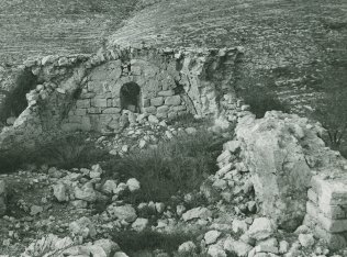
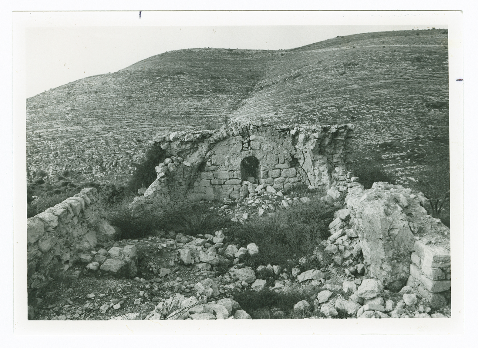
There is a large, deserted stone house on the site surrounded by old terraces. It is a one-storey house with an arched door and arched windows. Northwest of this house, at the bottom of a slope, stands another deserted house. Most of the village lands fell within the Demilitarized Zone that was delineated by the armistice agreement of 1949 between Israel and Jordan.