| Year | Arab | Total |
|---|---|---|
| 1931 * | 688 | |
| 1944/45 ** | 2300 | 2300 |
| Year | Arab | Public | Total |
|---|---|---|---|
| 1944/45 | 26619 | 7392 | 34013 |
| Use | Arab | Public | Total | ||||||||||||
|---|---|---|---|---|---|---|---|---|---|---|---|---|---|---|---|
|
8092 | 8092 (24%) | |||||||||||||
|
18527 | 7392 | 25919 (76%) |
Classified as a hamlet in the Palestine Index Gazetteer, al-Mansura stood on the northern shoulder of a mountain in Upper Galilee. The summit of the mountain rose behind the village, to its south, and wide expanses of land stretched out below the village to the east, west, and north. Al-Mansura remained part of Lebanon until 1923, when the British and French delineated the international borders in the area and placed it in Palestine. A secondary road connected it to the Acre–Ra's al-Naqura highway on the coast. Its houses were built at some distance from one another. Al-Mansura was predominantly Christian; it had its own church. ![]() It obtained drinking water from a well to the north and from three water tanks to the south. Its economy was based principally on agriculture and animal husbandry. Olive trees were planted on 900 dunums of land that belonged to the people in al-Mansura and the neighboring Fassuta and Dayr al-Qasi. In 1944/45 a total of 6,475 dunums of the lands of the three villages was allocated to cereals; 1,617 dunums were irrigated or used for orchards. Next to the village were two khirbas which contained building foundations, presses, cisterns, and the remains of a fort.
It obtained drinking water from a well to the north and from three water tanks to the south. Its economy was based principally on agriculture and animal husbandry. Olive trees were planted on 900 dunums of land that belonged to the people in al-Mansura and the neighboring Fassuta and Dayr al-Qasi. In 1944/45 a total of 6,475 dunums of the lands of the three villages was allocated to cereals; 1,617 dunums were irrigated or used for orchards. Next to the village were two khirbas which contained building foundations, presses, cisterns, and the remains of a fort.
The village was probably attacked in October 1948, during Operation Hiram Later, in mid–November 1948, the Israeli army decided to empty the Israeli side of the Israeli–Lebanese border of its Arab villages. The people of al-Mansura were ordered to leave; some crossed into Lebanon but most were taken in trucks to the village of al-Rama, to the south. In February 1949 the Maronite church appealed to the Israeli government on behalf of the villagers, asking that they be allowed to return to their homes, but the appeal was denied. For many years thereafter the villagers of al-Mansura who had remained in Israel continued to plead with the Israeli authorities, to no avail. ![]()
Netu'a , founded in 1966, is less than 1 km from the village site on village land. Elqosh was established in 1949 on part of the village land. Biranit was built in the early 1950s on village land; its original name was al-Mansura. Mattat , founded in 1979, and Abbirim , founded in 1980, are also on village lands.
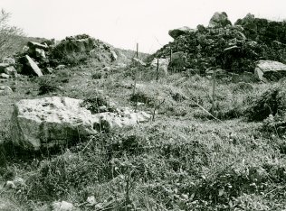
The village houses have been completely levelled. Much of the resulting debris has been pushed together in heaps along the northern edge of the site. Iron construction rods project from some of the larger blocks of cement. The site is used for grazing cows and has been enclosed by a wire fence. To the west of the site is a chicken coop belonging to the settlement of Netu'a. The only village structure that still stands is the church of Mari Yohanna, which is 200 m south of the site on the slope of the mountain. Its roof and parts of its walls have collapsed . Vines have been planted between the church and the village site, and a military airstrip and army base are on the top of the mountain, to the south.
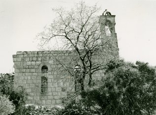
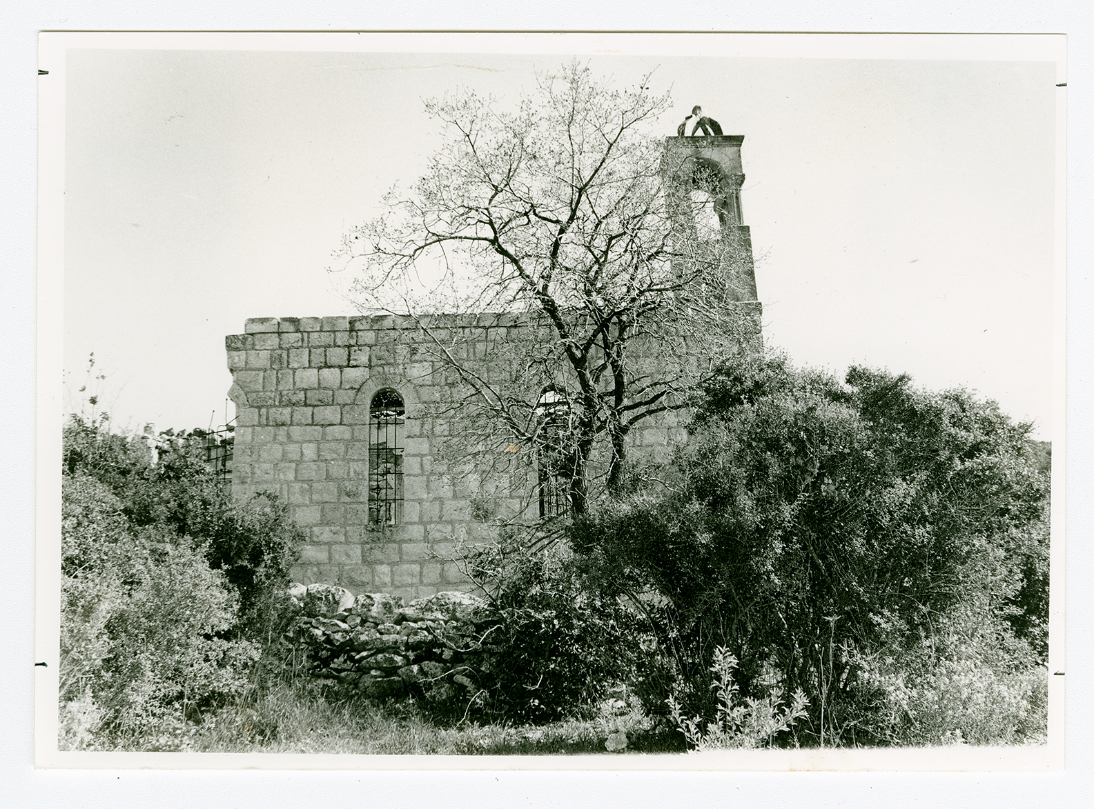
The church of Mari Yohanna, viewed from the southern edge of the site, looking east.
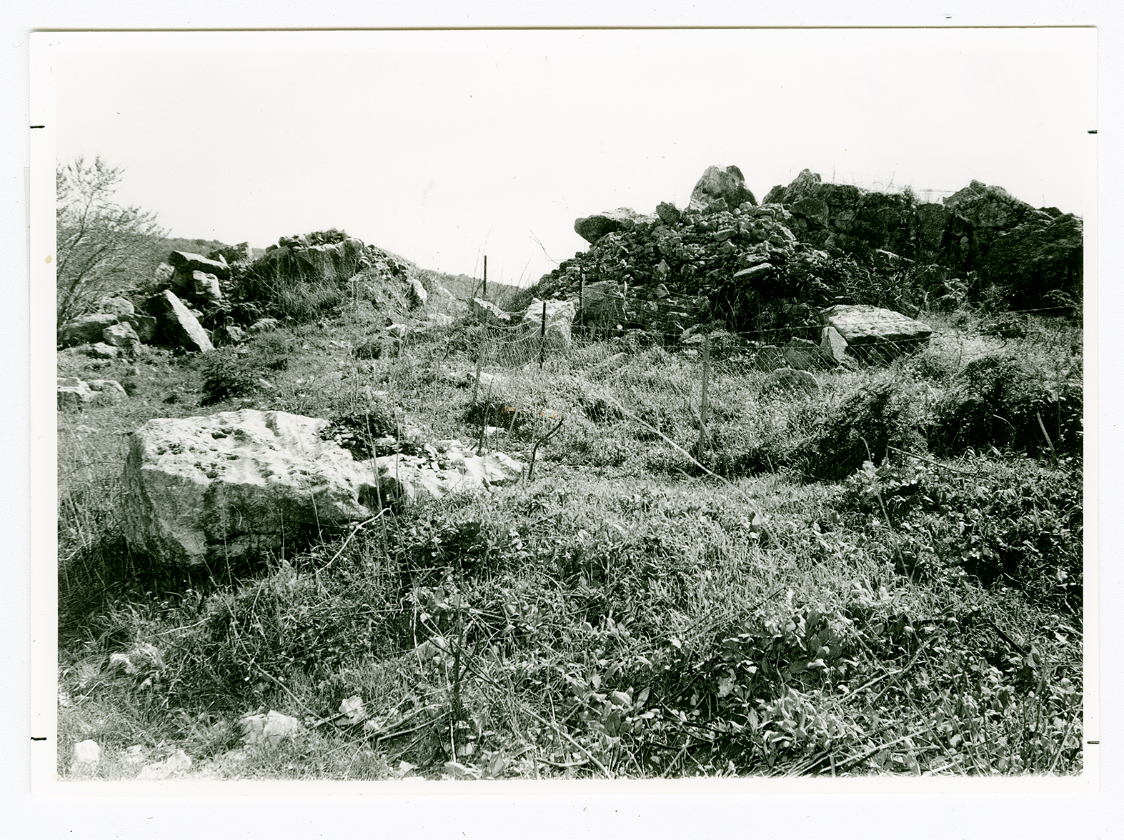
Rubble from village houses on the northen edge of the site.
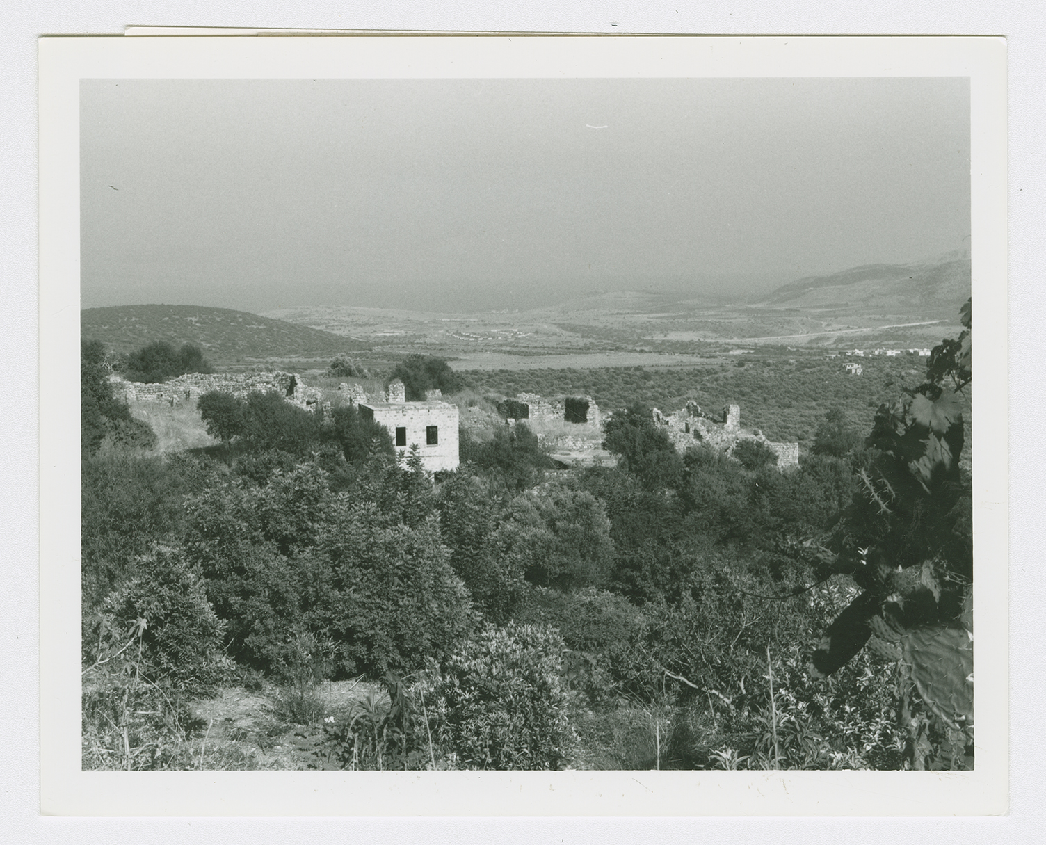
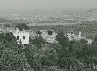
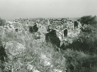
Ruined houses in al-Mansura.
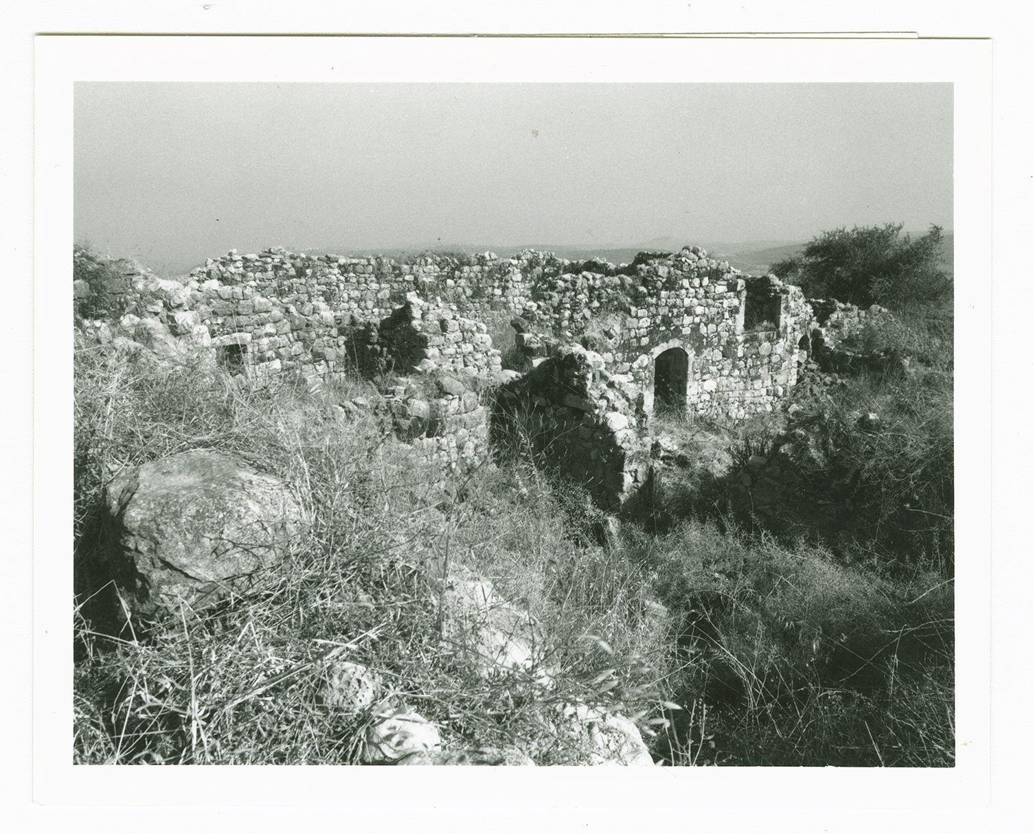
Ruined houses in al-Mansura.