| Year | Arab | Total |
|---|---|---|
| 1931 | 284 | |
| 1944/45 | 410 | 410 |
| Year | Arab | Public | Total |
|---|---|---|---|
| 1944/45 | 2728 | 80 | 2808 |
| Use | Arab | Public | Total | ||||||||||||
|---|---|---|---|---|---|---|---|---|---|---|---|---|---|---|---|
|
92 | 80 | 172 (6%) | ||||||||||||
|
2636 | 2636 (94%) |
The village was situated on flat terrain on the central coastal plain, It was linked by two secondary roads to Lydda and Ramla, and by dirt tracks to several neighboring villages. The village took its name from the Hebrew prophet Dani'el, called al-Nabi (the prophet) Daniyal in Arabic. It was not uncommon for Palestinian Muslims to honor such Old Testament prophets by building shrines for them; there was a shrine for the prophet Moses, for example, south of Jericho, not far from the region in which he is said to have been buried. Some of these shrines were built over the supposed tombs or birthplaces of these prophets, while others Simply commemorated the appearance of a prophet to a local believer in a dream,
In the late nineteenth century British Royal Engineers described the village as a small settlement built around a shrine for al-Nabi Daniyal. All of the residents were Muslims. The village houses, made of adobe brick or stone, were arranged along an east-west axis in a rectangular plan whose center consisted of shops. During the last years of the Mandate, house construction increased; the village expanded but followed the original layout. Daniyal had an elementary school with an enrollment of about forty-five students at the time of its founding in 1945. A well supplied the village with drinking water. The rainfed crops cultivated by the villagers included wheat, olives, and citrus. In 1944/45 a total of 2,599 dunums was allotted to cereals; 37 dunums were irrigated or used for orchards.
According to the History of the War of Independence, Israeli army units from the Yiftach Brigade moved into the village on 10 July 1948, during the first phase of Operation Dani (see Abu aI-Fadl, Ramla sub-disctrict), The villagers either fled or were evicted during the onslaught. The same forces went on to attack Lydda the following day. Nearby Jimzu was taken at the same time because, as the New York Times correspondent wrote, these two villages 'were more or less protective covering for the Lydda-Ramla area,'
Israeli prime minister David Ben-Gurion named this village as one of fourteen to be partially destroyed. He included it in a request that he made on 13 September 1948 to a special ministerial committee overseeing demolition and settlement activity. Israeli historian Benny Morris does not indicate whether or when the destruction took place.
The settlement of Kefar Daniyyel (143149) was established on the village site in 1949.
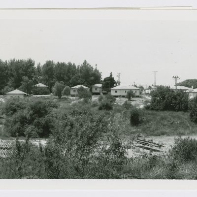
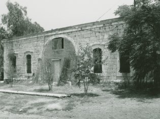
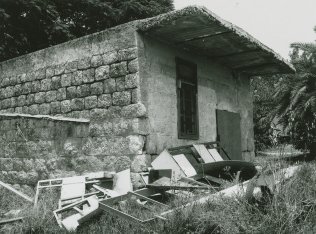
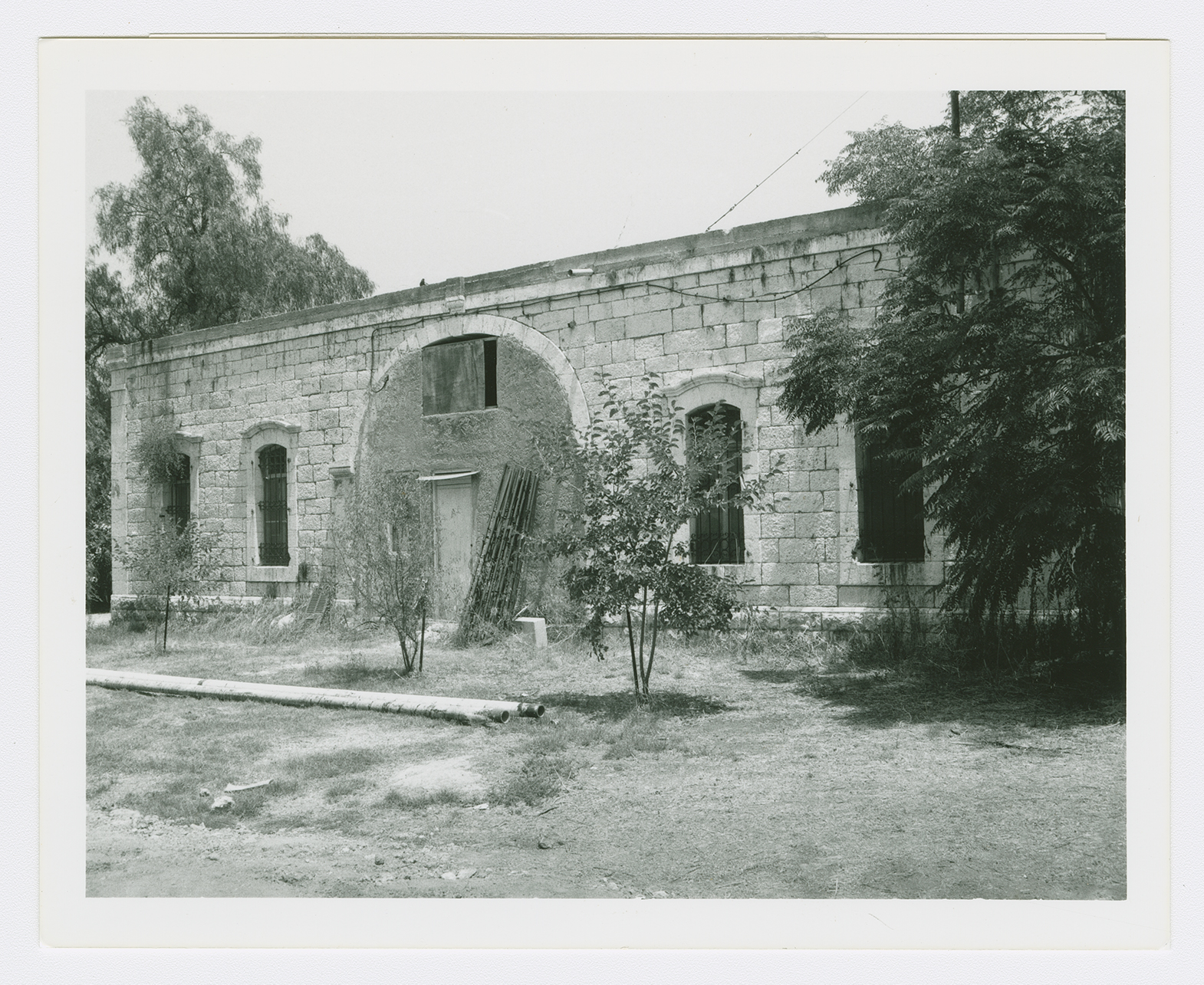
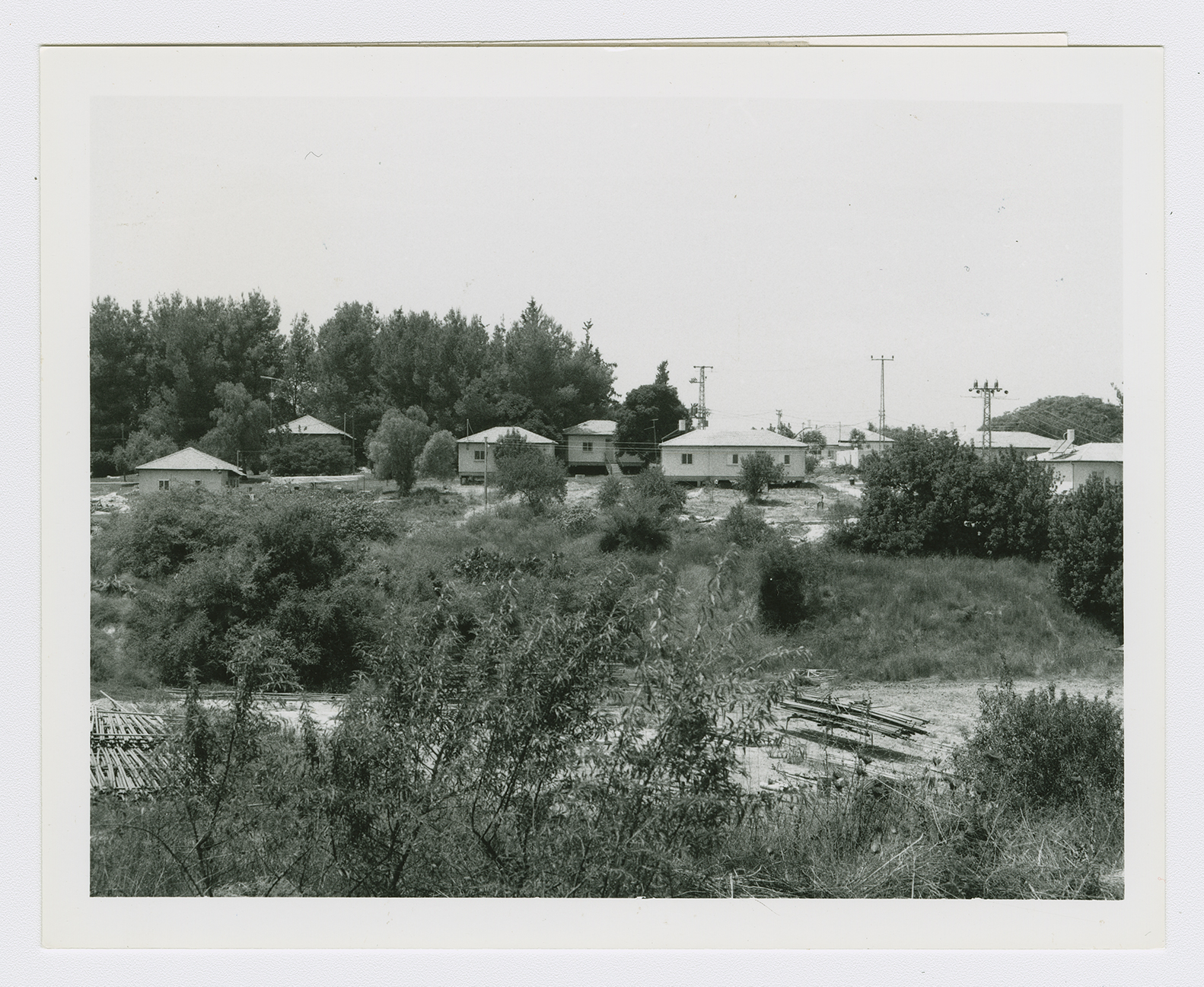
The shrine of al-Nabi Daniyal, the school, and seven well-built houses are all that remain of the village. The shrine, deserted amid weeds and a few trees, is made of stone, with a second storey rising on one side. The first storey has arched windows and doors and the second has a porch and a rectangular window. The school is presently used by residents of Kefar Daniyyel. The houses are built of stone and are all flat-roofed, with a mix of arched and rectangular doors and windows. One house is used as a warehouse. Cactuses, cypress, olive, and Christ's-thorn trees grow on the site, as well as castor-oil (ricinus) plants. The settlement's housing units also can be seen on the site (see photos). The lands around the site are cultivated by Israelis.
Related Content
Violence
End of First Truce: Israeli Operations An-Far, Dani and Qedem
1948
8 July 1948 - 17 July 1948
