| Year | Arab | Total |
|---|---|---|
| 1944/45 | 60 | 60 |
| Year | Arab | Public | Total |
|---|---|---|---|
| 1944/45 | 1195 | 1195 |
| Use | Arab | Total | |||||||||
|---|---|---|---|---|---|---|---|---|---|---|---|
|
459 | 459 (38%) | |||||||||
|
736 | 736 (62%) |
The village was located on a flat hilltop on the central coastal plain that was surrounded by lower hills. It overlooked wide expanses of land on all sides, and was connected by a secondary road to the highway leading to Ramla and Lydda. Dirt paths connected it to several neighboring villages as well. On the eastern outskirts of the village was a shrine for a Shaykh Abu Salama; this most probably was the source of the village's name. Dayr Abu Salama had an irregular layout. Classified as a hamlet by the Palestine Index Gazetteer, its population was predominantly Muslim, and its houses were built of adobe brick. Its agricultural lands, which lay mainly to the north, were endowed with fertile soil and an abundance of ground water, including two reservoirs in the area. Cultivated crops included grain, vegetables, olives, citrus fruits, grapes, and figs. In 1944/45 a total of 695 dunums was allocated to cereals; 41 dunums were irrigated or used for orchards. The village contained the remains of a monastery and rock-cut tombs.
After occupying Lydda in the first phase of Operation Dani (see Abu aI-FadI, Ramla sub-disctrict), Israeli forces proceeded to fan out into the town's hinterland, overrunning a number of nearby villages. Israeli historian Benny Morris indicates that Dayr Abu Salama fell on 13 July 1948, but does not say what happened to its residents. It is likely that those who remained in their homes were expelled by the invading units, as was the case in Lydda, Ramla, and many of the villages which fell during the operation. Two days before the village was captured, Operation Dani headquarters ordered the Yiftach Brigade 'to dig in in every place captured and to destroy every house not intended for occupation [by Israeli troops].'
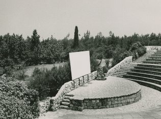
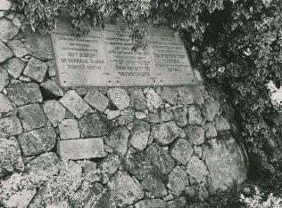
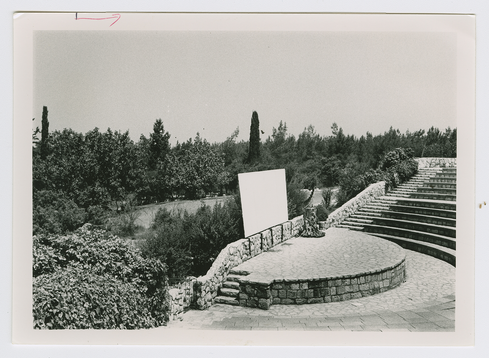
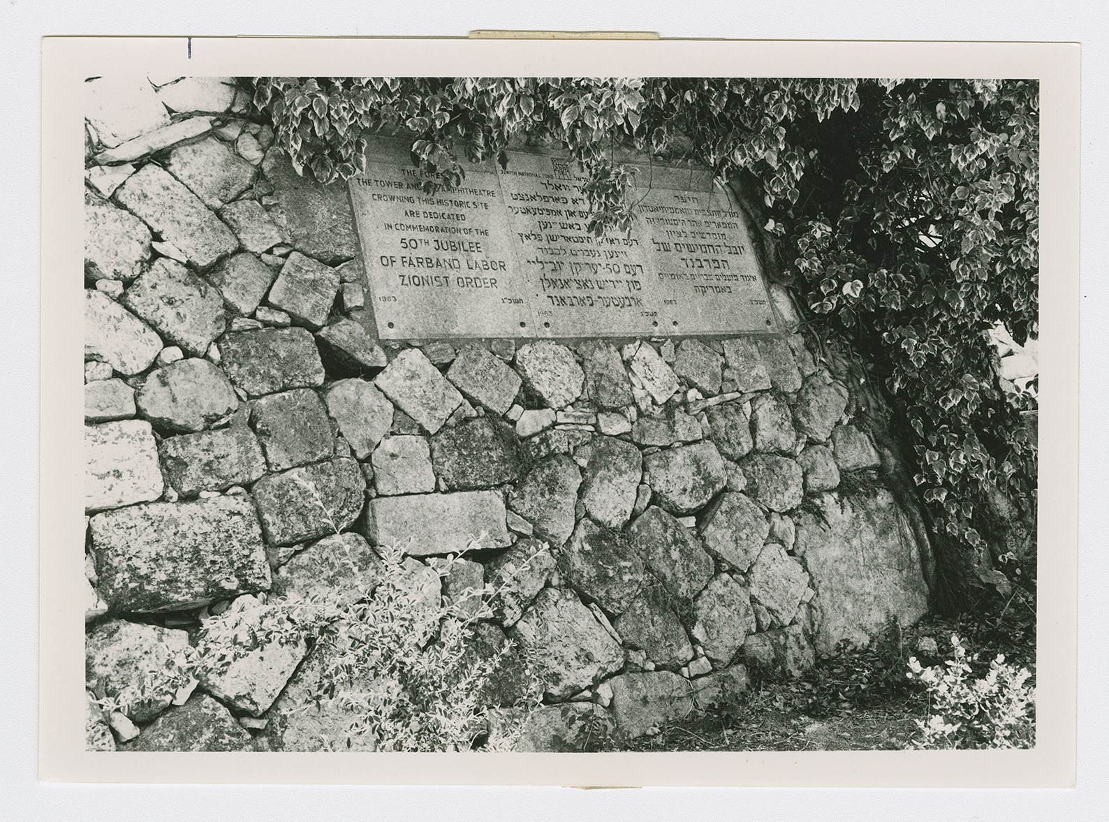
The site has been converted into an Israeli picnic area and is surrounded by stands of pine and cypress trees. Workers for the Jewish National Fund have used stones retrieved from the destroyed village houses to construct a watchtower and an amphitheater on the village site (see photos). The area in front of the amphitheater has been levelled and is covered by a green lawn. Old fig and olive trees still grow there; cactuses and carob trees grow on the western and northern edges of the site.
Related Content
Violence
End of First Truce: Israeli Operations An-Far, Dani and Qedem
1948
8 July 1948 - 17 July 1948


