| Year | Arab | Total |
|---|---|---|
| 1931 | 317 | |
| 1944/45 | 500 | 500 |
| Year | Arab | Public | Total |
|---|---|---|---|
| 1944/45 | 87 | 8482 | 8569 |
| Use | Arab | Public | Total | ||||||||||||
|---|---|---|---|---|---|---|---|---|---|---|---|---|---|---|---|
|
714 | 714 (8%) | |||||||||||||
|
87 | 7768 | 7855 (92%) |
The village stood on a stretch of sandy, rolling land in the northern Negev. A network of secondary roads linked it to the highways between Gaza and Julis, which ran parallel to the coastal highway. Kawfakha was founded in the late nineteenth century by Gaza city residents who came to cultivate the surrounding land. At its center was a mosque that was well-known in the region, built during the reign of the Ottoman sultan Abd al-Hamid II (1876–1909). Houses were spread along a northwest–southeast axis in a rectangular pattern, adjacent to the southern bank of Wadi Abu Shunnar, a tributary of Wadi Hawdaj. Kawfakha had an elementary school and some small shops. Its inhabitants, who were Muslim, obtained water for domestic use from two wells inside the village. For agriculture, they relied on both rainfall and irrigation (from wells, cisterns, and reservoirs that collected rainwater in winter). They planted the land on the northern side of the village with fruit trees, such as apricots, olives, almonds, grapes, and figs, and grew grain on the other sides. In 1944/45 a total of 87 dunums was irrigated or used for orchards, and 7,768 dunums (of public land) were allotted to cereals. The village contained the ruins of Khirbat al-Kawfakha which included remnants of cisterns, marble columns, a Corinthian capital, mosaic walkways, and pottery.
The village was raided by units of the Negev Brigade on the night of 27–28 May 1948, according to Israeli historian Benny Morris. The New York Times reported on 30 May that it had been captured along with the adjacent village of al-Muharraqa. The inhabitants were driven out of the village, although they had 'earlier repeatedly asked to surrender, accept Jewish rule and be allowed to stay, all to no avail.' Their request to remain in the village was denied by the Israeli authorities on the grounds that such requests were always 'either insincere or unreliable.'
The settlement of Nir 'Aqiva was established in 1953 on village lands, southwest of the village site.
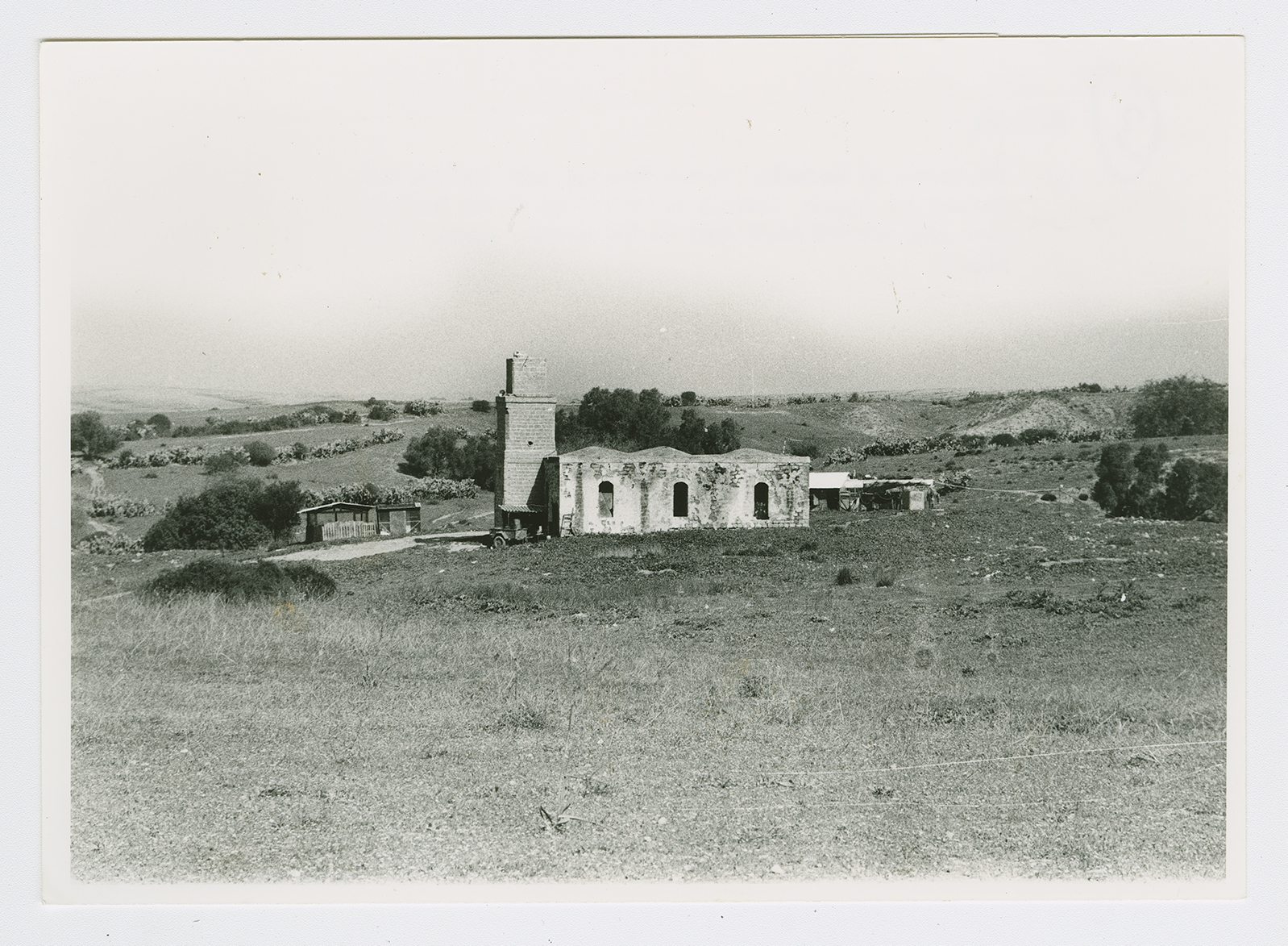
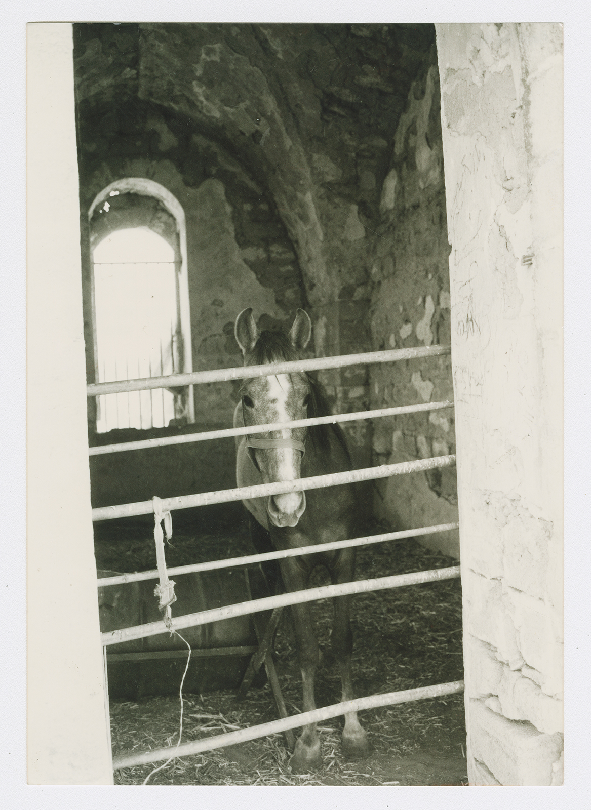
Only the mosque remains, and it is used as a storehouse for animal fodder and as a horse stable. It is a stone structure with arched entrances and windows on all sides; its roof is topped by three shallow domes. The site, which contains piles of rubble and is overgrown with cactuses and other desert plants, has been fenced in and serves as a pasture. There is a citrus grove west of it, and grain is grown by Israeli farmers on part of the surrounding land.

The mosque of Kawfakha, viewed from the east looking west. Stables for horses, visible on both sides of the building, have been erected right next to the mosque.

The interior of the village mosque, now used as a stable for horses. The narrow window in the background appears in the adjacent picture of Kawfakha to the left, at the end of the building farthest from the minaret.

