| Year | Arab | Total |
|---|---|---|
| 1944/45 * | 340 | 340 |
| 1931 ** | 215 | 215 |
| Year | Arab | Public | Total |
|---|---|---|---|
| 1944/45 * | 5104 | 1734 | 6838 |
| Use | Arab | Public | Total | ||||||||||||
|---|---|---|---|---|---|---|---|---|---|---|---|---|---|---|---|
|
4908 | 219 | 5127 (75%) | ||||||||||||
|
196 | 1515 | 1711 (25%) |
The village was located on a sandstone hill on the coastal plain, about 1 km from the seashore. The coastal railway passed some 200 m to its west. According to the Arab geographer Yaqut al-Hamawi (d. 1228), the town of Kafr Lam was established near Qisarya (Caesarea) by the Umayyad caliph Hisham ibn 'Abd al-Malik (A.D. 724-743). ![]() The Crusaders built a castle there called Cafarlet which was captured by the Muslims in 1265. It was subsequently regained by the Crusaders, only to be taken by Mamluk forces in 1291. In 1596 a farm in Kafr Lam paid taxes to the government.
The Crusaders built a castle there called Cafarlet which was captured by the Muslims in 1265. It was subsequently regained by the Crusaders, only to be taken by Mamluk forces in 1291. In 1596 a farm in Kafr Lam paid taxes to the government. ![]() The French traveler Guerin
The French traveler Guerin ![]() noted in mid-19th that Kafr Lam was situated on top of a small hill and was inhabited by about 300 villagers. He said that the village stood within a large stone enclosure which dated to the time of the Crusades.
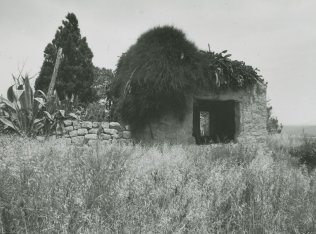
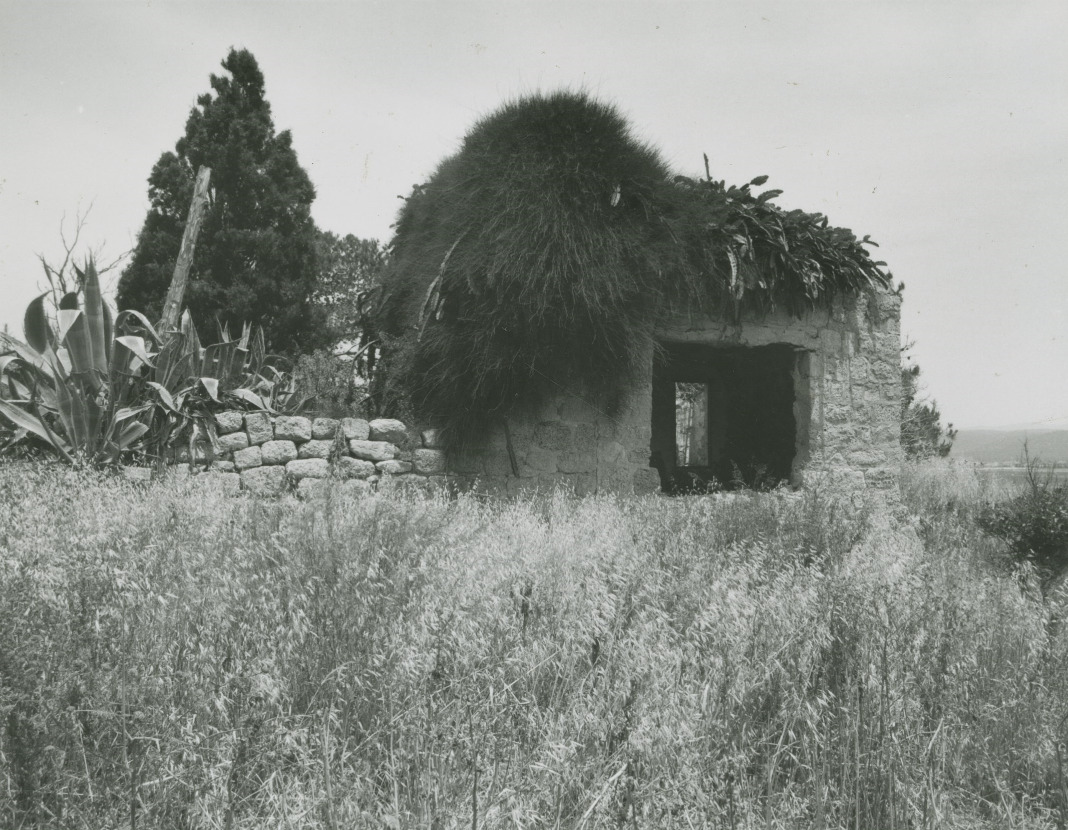
noted in mid-19th that Kafr Lam was situated on top of a small hill and was inhabited by about 300 villagers. He said that the village stood within a large stone enclosure which dated to the time of the Crusades. ![]() Mary Rogers, the sister of Edward Rogers (the British vice-consul in Haifa) visited Kafr Lam in 1856. She wrote that its houses were built of mud and stone and that the fields around the village abounded in Indian wheat, millet, sesame, tobacco, and orchards.
Mary Rogers, the sister of Edward Rogers (the British vice-consul in Haifa) visited Kafr Lam in 1856. She wrote that its houses were built of mud and stone and that the fields around the village abounded in Indian wheat, millet, sesame, tobacco, and orchards. ![]()
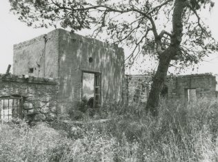
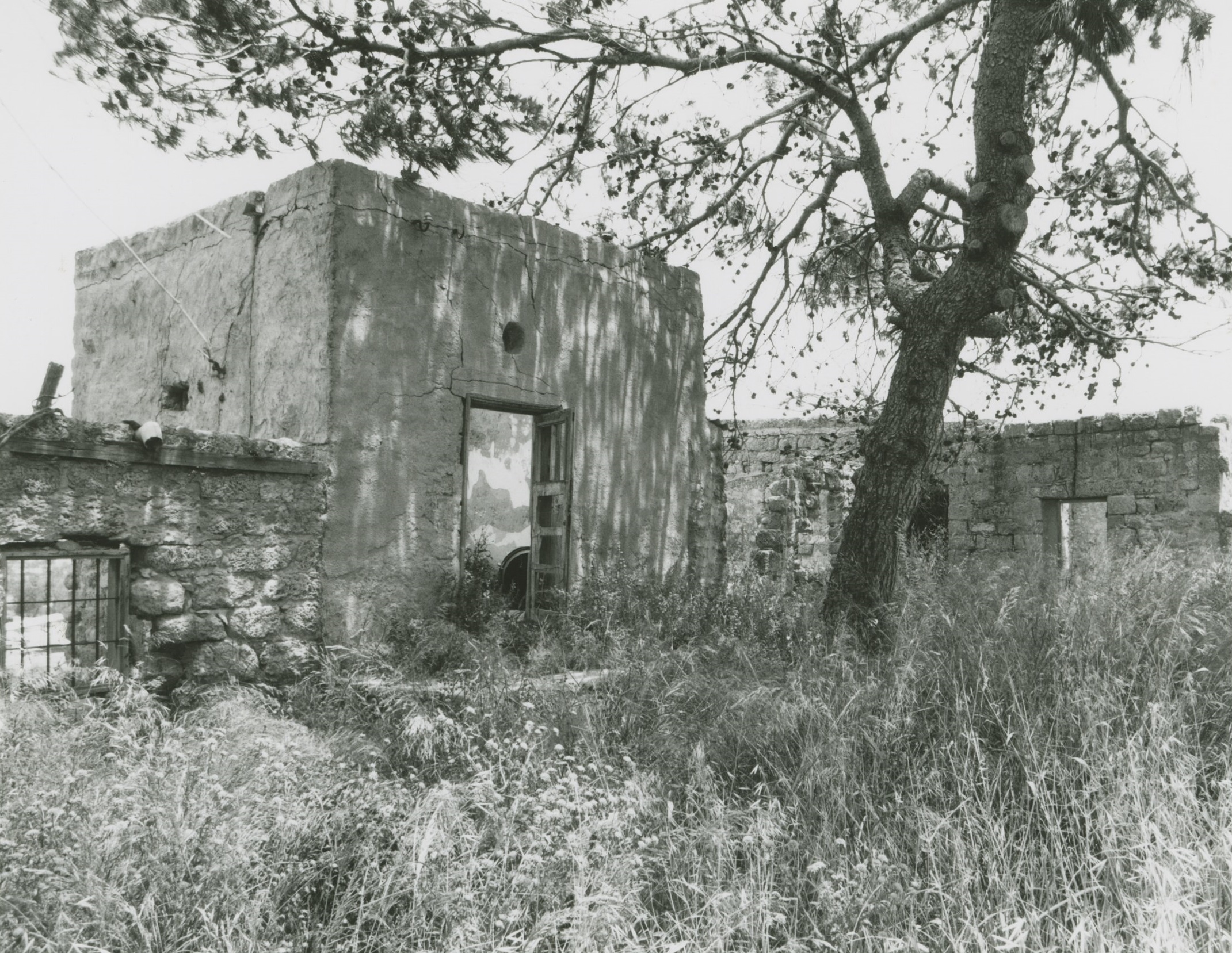
In modem times the houses of Kafr Lam were made of stone and either mud or cement and were clustered together. The villagers were Muslims, and maintained a mosque; a boys' elementary school was built in 1882, but it was closed during the Mandate. There were five wells on village lands. The village economy depended on animal husbandry and agriculture. The main crops were various sorts of grain. In 1944/45 a total of 4,833 dunums were allotted to cereals; 75 dunums were irrigated or used for orchards. The antiquity of Kafr Lam documented in the literary sources remains evident from the partly-visible archaeological remains, chiefly the Crusader's fortress and stone quarries.
During the Ten Days between the two truces of the war (8-18 July 1948), a number of Israeli military operations were carried out that resulted in the occupation of a string of villages just south of Haifa. One of the smaller of these operations was directed against Kafr Lam. This limited thrust took place around 15-16 July and resulted in the occupation of Kafr Lam, as well as al-Tira, al-Sarafand, and perhaps 'Ayn Hawd. The History of the War of Independence states that this operation involved the first use of support fire from naval forces; two warships participated in the attack, aiming light weapons fire at Kafr Lam and al-Sarafand. This account does not mention the fate of the villagers; however, nearby al-Tira, which was occupied during the same operation, was depopulated by its attackers. According to Israeli historian Benny Morris, the occupying units sent some of al-Tira's villagers to the Triangle area and others to POW camps. ![]()
In 1949, Zionist immigrants from South Africa and Britain established the settlement of ha-Bonim (143226) to the west of the village site, on village lands. Another settlement, 'En Ayyala (145226), was established in 1949 southeast of the site, also on village lands.
The abandoned Crusader fortress and several houses are still standing. One house, that of Ahmad Bey Khalil, has been converted into a school; another is being used as an Israeli post office.