PLace

Barqa

Place
Barqa — بَرْقَة
District
Gaza
Subdistrict
Gaza
Average Elevation
25 m
Distance from Gaza
37 km
Population
Year Arab Total
1931 594 600
1944/45 890 890
Land Ownership (1944/45) in dunums
Year Arab Jewish Public Total
1944/45 4841 226 139 5206
Land Use (1944/45) in dunums
Use Arab Jewish Public Total
Non-Cultivable & Built-up (Total)
Use Arab Jewish Public Total
Built-up 26 8 34
Non-Cultivable 203 85 139 427
229 93 139 461 (9%)
Cultivable (Total)
Use Arab Jewish Total
Citrus and Bananas 667 667
Plantation and Irrigable 47 47
Cereal 3898 133 4031
4612 133 4745 (91%)
Number of Houses (1931)
123

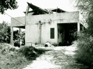
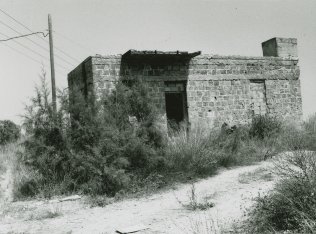
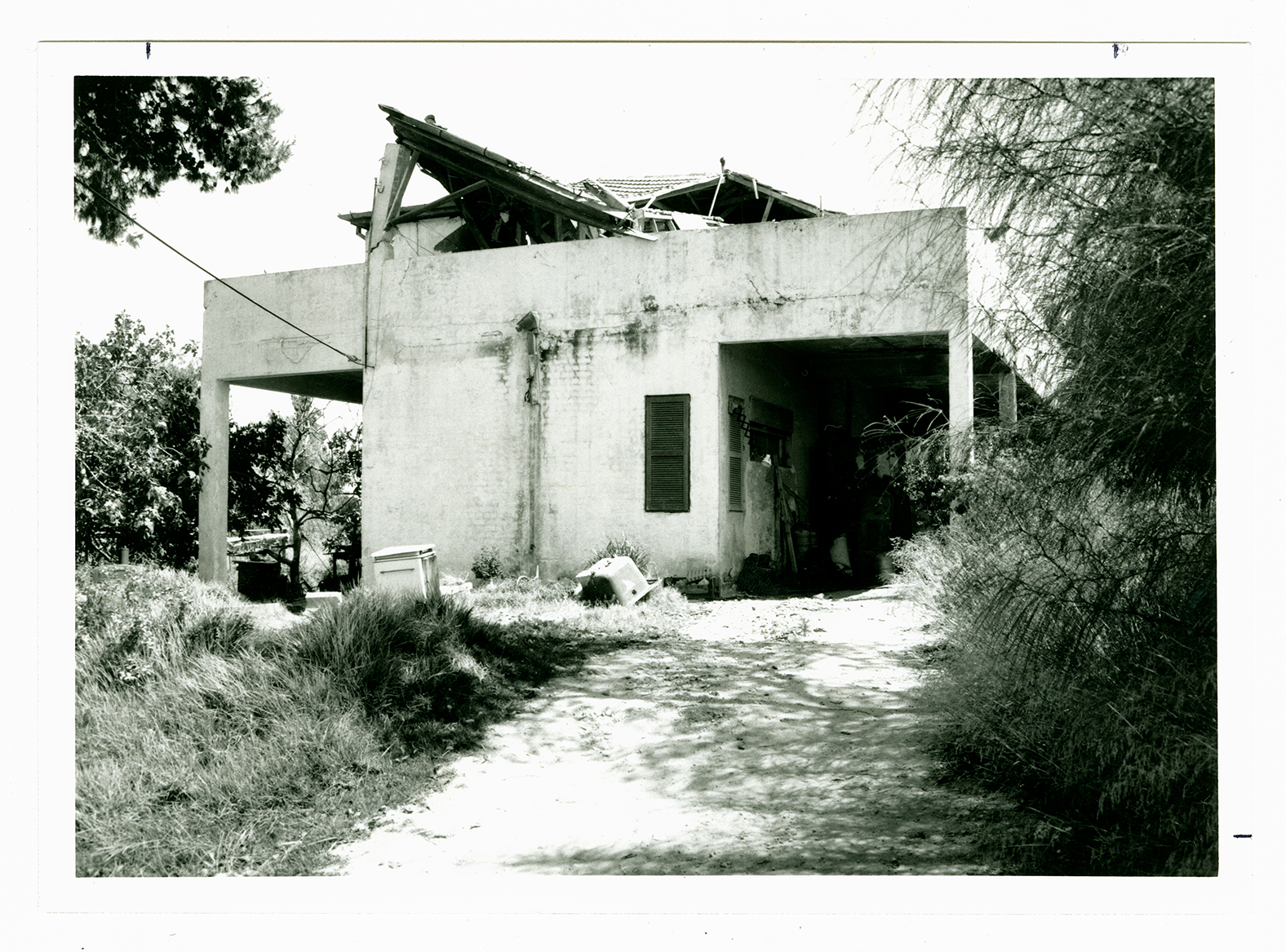
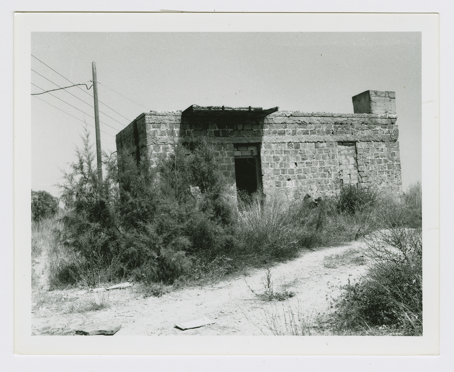
The village was situated on level ground in the coastal plain area, some 7 km from the Mediterranean. A secondary road linked it to the coastal highway, which gave it access to Gaza as well as to the urban centers in the north. It is likely that Barqa was built on the site of the Greek town of Barka, which the Romans called Bareca. Barqa was irregular in outline. Its houses―made, for the most part, of adobe brick―were close together, separated only by narrow alleys. The villagers were Muslim, and around the village mosque were a number of tombs that they referred to as the tombs of Shaykh Muhammad, Shaykh Zarruq, and the prophet (al-nabi) Barq. Small shops were located at the village center. The children attended school in the adjacent village of al-Batani al-Gharbi . Agriculture constituted the mainstay of the economy, which combined basic staples such as grain and vegetables with fruits, especially citrus. In 1944/45 a total of 667 dunums was devoted to citrus and bananas and 3,898 dunums were allotted to grain; 47 dunums were irrigated or used for orchards. The village residents drilled several wells for irrigation, although agriculture remained largely rainfed. Barqa contained Greek relics, including a well, stone carvings, and fragments of pottery.

The village is said to have been evacuated by its inhabitants at the beginning of an attack by the Haganah's Giv'ati Brigade between 10 and 13 May 1948. Giv'ati was expanding its area of control southwards and westwards in the course of Operation Barak.

There are no Israeli settlements on village lands. Gan Yavn, established in 1931, is close to the village site, to the north. The settlement of Shetulim , built in 1950, is near the village, on the lands of Isdud.

Two houses remain standing on the site. One serves as a warehouse; it is made of concrete and has a covered portico on two sides. The other, a stone house with rectangular doors and windows and a flat roof, stands deserted in the midst of wild vegetation. The site is overgrown with weeds interspersed with cactuses and eucalyptus and palm trees. Israelis cultivate the land around the site.