| Year | Arab | Jews | Total |
|---|---|---|---|
| 1931 | 3140 | ||
| 1944/45 | 4620 | 290 | 4910 |
| Year | Arab | Jewish | Public | Total |
|---|---|---|---|---|
| 1944/45 | 32905 | 2487 | 12479 | 47871 |
| Use | Arab | Jewish | Public | Total | ||||||||||||||||||||
|---|---|---|---|---|---|---|---|---|---|---|---|---|---|---|---|---|---|---|---|---|---|---|---|---|
|
492 | 12013 | 12505 (26%) | |||||||||||||||||||||
|
32413 | 2487 | 466 | 35366 (74%) |
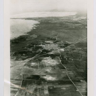
The village stood on a sandy hill that overlooked wide areas to the east, north, and south, and faced a higher hill to the west. This hill was in fact the accumulated remains of many earlier towns with the same name. Isdud was about 5 km from the seashore, on the coastal highway, and next to the railway line. Its name was derived from that of the ancient town of Ashdod, which dated back to at least the seventeenth century B.C. According to the Bible (Joshua 13:1–3) it was one of the five major cities of the Philistines (the pentapolis). It should be distinguished from the harbor town which was known in the classical period as Azotos Paralios (or Minat al-Qal'a [114131] ), that is, 'by the sea.' This town was separated from Isdud by a 5-km-wide band of sand dunes. After the town was devastated by the Maccabees in the second century B.C. it was rebuilt, less than a century later, as a Roman town. Its name at that time was Azotus. During the Byzantine period the port town became more important than the mother town itself.
Isdud came under Muslim rule in the seventh century. The Persian geographer Ibn Khurdadhbi (d. 912) called it Azdud and said it was a postal station between Ramla and Gaza. The Marnluk sultan Qaytbay (1467–1496) was said to have passed through the village in 1477 on his way to Damascus. (‘Attallah 1986:72–73]" In 1596, Isdud was a village in the nahiya of Gaza (liwa' of Gaza), with a population of 413. It paid taxes on a number of crops, including wheat, barley, sesame, and fruit, as well as on other types of produce such as goats and beehives.
The Egyptian Sufi traveler As'ad al-Luqaymi, writing in 1730, reported visiting the
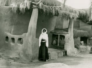
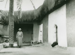
In the late nineteenth century, the village of Isdud ran along the eastern slope of a low, garden-covered hill. The (by then) ruined khan stood southwest of the village. Its houses were one-storey high with walls and enclosures all built of adobe brick. The two main sources of water, a masonry well and a pond, were surrounded by groves of date-palm and fig trees. Baedeker estimated that it had 5,000 inhabitants before World War I and described it as standing 'on the slope of a hill commanded by a still higher eminence.'
Isdud's Arab population was primarily Muslim. The village had two mosques and three tomb-shrines for Muslim historical and religious figures. The villagers erroneously believed that one of the shrines belonged to Salman al-Farisi, a companion of the prophet Muhammad. His shrine stood inside a mosque that had been built during the reign of the Mamluk sultan al-Zahir Baybars (1259–1277). A second shrine was believed to belong to an Egyptian, Shaykh al-Matbuli, and a third was devoted to Ahmad Abu al-Iqbal. Two elementary schools were established in Isdud, one for boys (opened in 1922) and a second for girls (built in 1942). The number of students reached 371 in the boys' school and 74 in the girls' by the mid-1940s. Isdud had a village council.
Agriculture constituted the village's main source of livelihood. The main crops were fruit—especially citrus, grapes, and figs—and grain, particularly wheat. In 1944/45 a total of 1,921 dunums was devoted to citrus and bananas and 22,170 dunums were allocated to cereals; 8,322 dunums were irrigated or used for orchards. The villagers relied on both rainfall and irrigation from wells (which ranged from 15 to 35 m in depth) for water for their crops. In addition to agriculture, the inhabitants worked in commerce. Isdud had a number of shops and held a weekly Wednesday market that attracted people from neighboring villages. Commerce was facilitated by Isdud's train station, which was part of the coastal railway.
In the vicinity, nine khirbas contained a wide variety of relics, including pottery fragments, mosaic floors, cisterns, and an ancient olive press. Excavations of the site itself determined that it had been occupied almost continuously from the seventeenth century B.C. until 1948. In antiquity its most flourishing periods appear to have been in the fourteenth and thirteenth centuries B.C.
When Egyptian forces entered Palestine on 15 May 1948, one of their early objectives was to take up positions in Isdud. This task was assigned to the Egyptian Ninth Battalion. But on 22 May a new battalion reached the front, and Isdud was handed over to the Sixth Battalion, according to former Egyptian president Gamal Abdel Nasser, then a staff officer in that Battalion: (The foreign press did not report that an Egyptian column had reached Isdud until 30 May, but Abdel Nasser's eyewitness account seems more reliable.) At that point, Isdud was on the front lines between the Egyptian and Israeli forces. Israeli forces briefly cut off the road between al-Majdal and Isdud, but the Egyptians managed to dislodge them, thus restoring their supply lines. This occurred during the Israeli army's Operation Barak .
The Israeli operational orders also called for an attack on al-Majdal, Isdud, or Yibna, to 'cause the wandering [i.e., exodus] of the smaller settlements in the area.' A three-pronged attack was launched on 2–3 June which led to the flight of thousands among the local population, according to Israeli historian Benny Morris. The New York Times reported that the 'bloodiest fighting' in the south of the country on 3 June was taking place around Isdud. Another Israeli attack was initiated a few days later, on 9–10 June. The following day, the first truce of the war took effect. Throughout the truce, Abdel Nasser was stationed at Isdud, from which he monitored Israeli military activity during this period. In the period between the two truces, Israeli commando units carried out raids in the vicinity of Isdud. A New York Times story on 16 July indicated that a unit named 'Samson's Foxes' had reached Egyptian positions at Isdud.
The town of Isdud was not occupied until the end of the second truce of the war, in October 1948. It came under naval and aerial attack at the beginning of Operation Yoav and fell into Israeli hands in the last stage of the operation.
The earlier stages of Operation Yoav were coordinated with parts of Operation Ha-Har, which was carried out by the Giv'ati Brigade further north. The Giv'ati Brigade stormed a number of villages in Hebron sub-disctrict while other forces implemented Operation Yoav. Numerous villages in Hebron sub-disctrict fell into Israeli hands on 22–23 October. Many of the people in the hills around Hebron fled before the arrival of Israeli troops; those remaining were expelled towards Hebron. Towards the end of operations Ha-Har and Yoav, in the last week of October 1948, the operational areas were merged. Israeli units broke through Egyptian lines on 23 October 1948, linking the Israeli-held parts of the Hebron hills with the Jerusalem corridor.
The New York Times stated on 18 October that Israeli air force bombers had flown 'practically unhindered' to their targets for three nights in succession and that these targets included Isdud. The Egyptians were in danger of being encircled and isolated and withdrew southwards along the coastal road. The bulk of the remaining civilian population fled with the retreating Egyptian columns before the Israeli entry on 28 October. According to Morris, some 300 townspeople remained, putting up white flags, and 'they were almost immediately expelled southwards.' Nevertheless, an Israeli army communiqué issued on the date of occupation claimed that Israeli forces had entered Isdud at the request of a delegation from the local Arab population.
Two settlements, Sde 'Uzziyyahu and Shetulim, were established east of the Site, on village lands, in 1950. Bene Darom and Gan ha-Darom, founded in 1949 and 1953, respectively, are at a good distance to the north of the village site, on village lands.
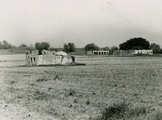
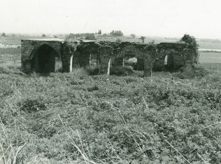
Most of the houses have been destroyed; the rubble is covered with grasses and thorns. Just south of the center of the site stands a large, ruined mosque. Its crumbling pillars are still standing, and its arched entrances and windows still retain their distinctive shape. About 200 m southwest of the site are two deserted school buildings; a neglected shrine stands close to them to the south. The main street of the village can still be seen running north to south on one side of the site; a large unused building remains on its east side. Palm, doum palm, and cypress trees are scattered around the perimeter of the site. An avocado grove has been planted along the northern edge of the site, and Israeli agricultural fields lie along its southern edge.
Related Content
Violence
Operations Yoav and ha-Har in the South Put End to 2nd Truce
1948
15 October 1948 - 4 November 1948
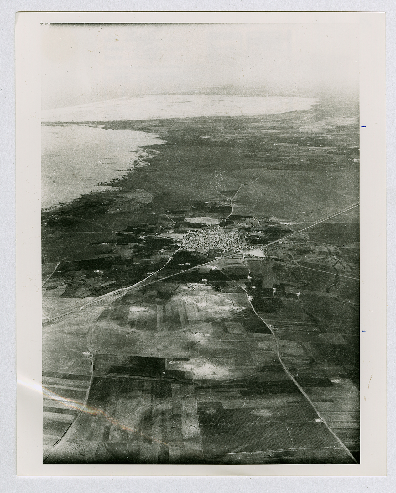
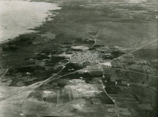
An aerial view of Isdud.
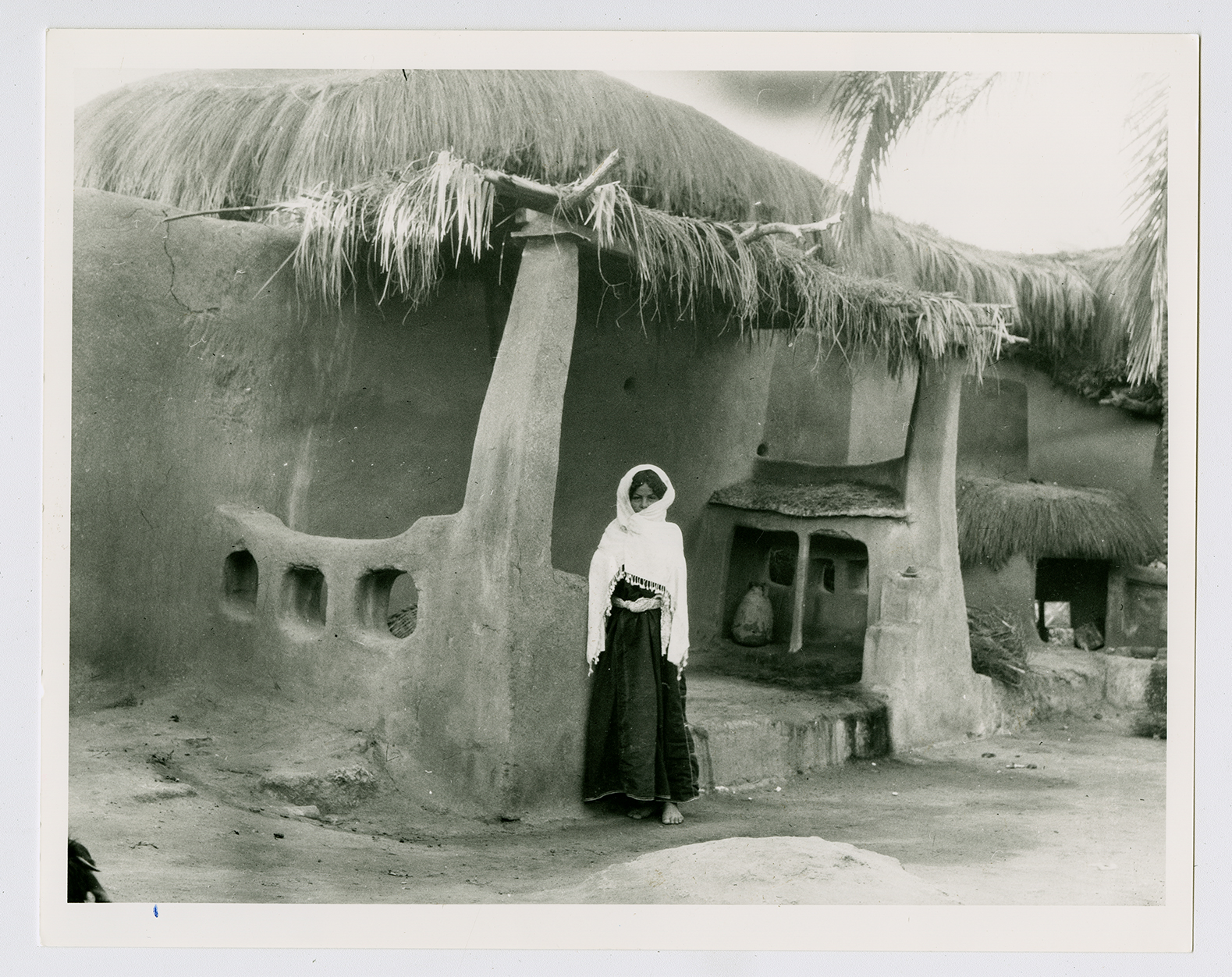
The courtyard of a house in Isdud.
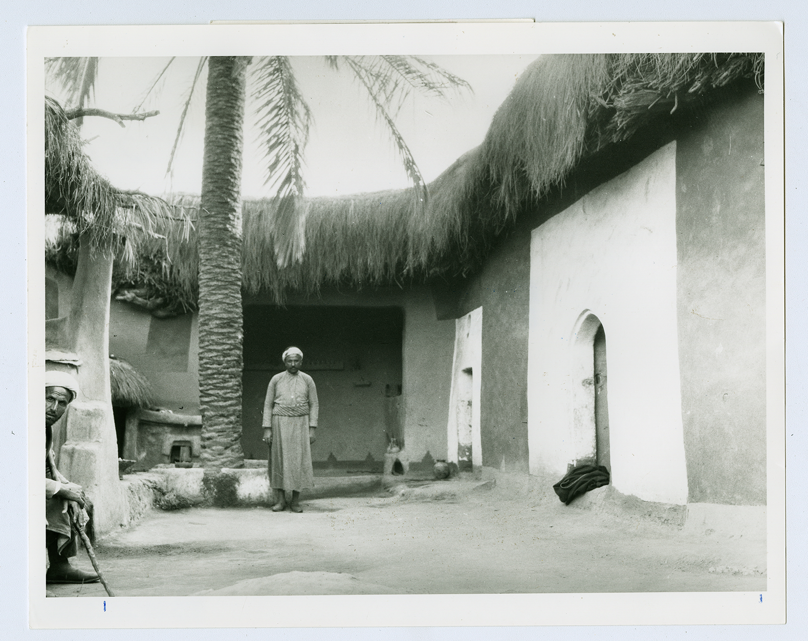
The same courtyard, viewed from another angle.
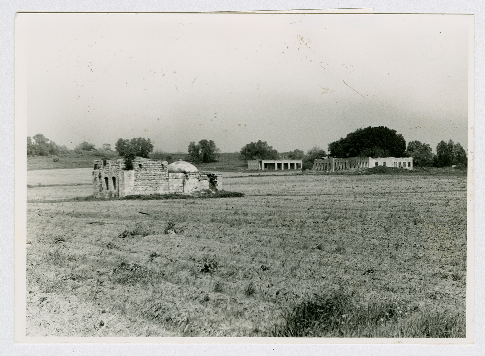
All that remains of Isdud: a saint's tomb (left), school buildings (right), and a ruined mosque (not visible, far to the right), viewed from a point southwest of the tomb, looking northeast. These ruins are west of the center of the site, where most of the village houses once stood.
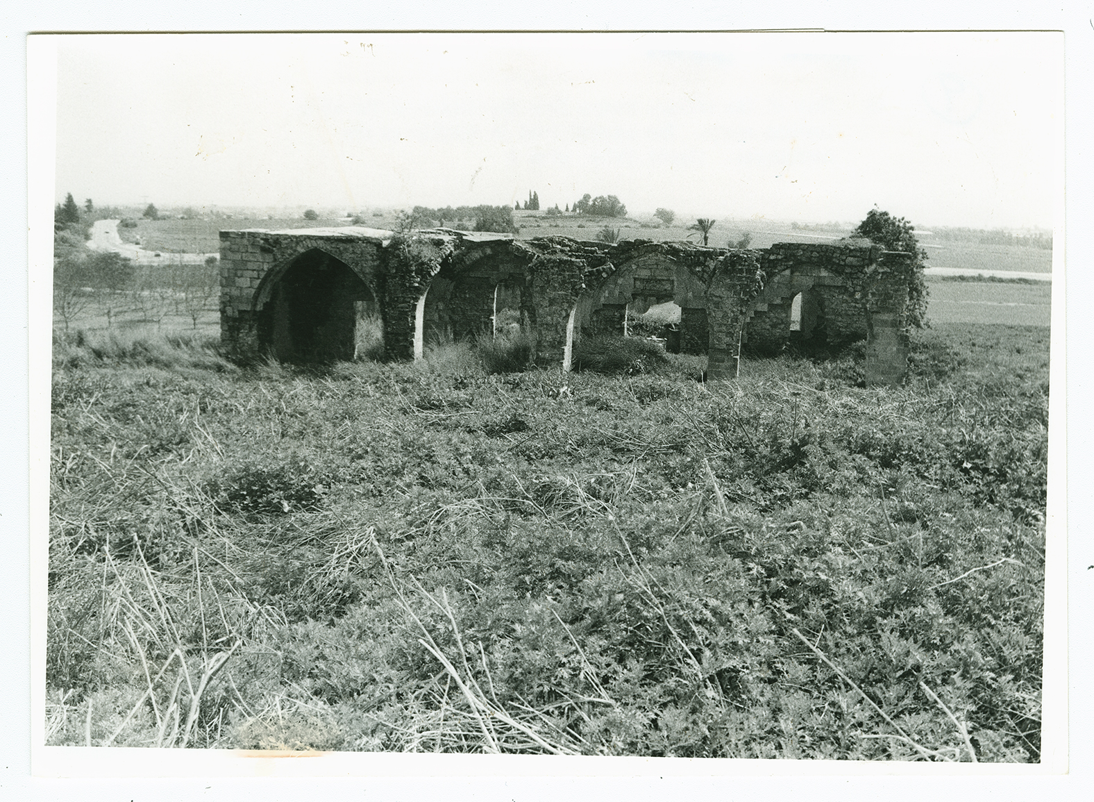
View of the village mosque from the center of the site, looking south. The coastal road is visible in the background.
