| Year | Arab | Total |
|---|---|---|
| 1931 | 353 | 353 |
| 1944/45 | 450 | 450 |
| Year | Arab | Public | Total |
|---|---|---|---|
| 1944/45 | 11607 | 4137 | 15744 |
| Use | Arab | Public | Total | ||||||||||||
|---|---|---|---|---|---|---|---|---|---|---|---|---|---|---|---|
|
4277 | 4137 | 8414 (53%) | ||||||||||||
|
7330 | 7330 (47%) |
The village was located on the lower slopes of the Hebron Mountains. A secondary road linked it to Bayt Jibrin (4 km due south) and hence to Hebron, Bethlehem, and al-Faluja similar roads and dirt paths connected it to the area's villages. Kudna was known to the Crusaders as Kidna. In the late nineteenth century, Kudna was a small village situated on a low hill and surrounded by olive trees. The walls of a Crusader castle rose from the middle of the village. ![]() The people of Kudna were Muslims who built their houses along the track from Bayt Jibrin to Dayr al-Dubban, which ran through the village in a north-south direction and constituted its main street. During the Mandate new housing was constructed northward along this street.
The people of Kudna were Muslims who built their houses along the track from Bayt Jibrin to Dayr al-Dubban, which ran through the village in a north-south direction and constituted its main street. During the Mandate new housing was constructed northward along this street.
The community obtained its drinking water from a well on the eastern edge of the village. Its agricultural land, the bulk of which was located on the west side, was planted in grain, vegetables, and fruits such as figs and olives. Agriculture was rainfed. In 1944/45 a total of 6,505 dunums was allocated to cereals 825 dunums were irrigated or used for orchards. The uncultivated land in the vicinity, with its shrubs and wild grasses, served as grazing grounds for the goats and sheep that were raised by the villagers. An archaeological site in Kudna contained remnants of a fort, the foundations of buildings, previously inhabited caves, and cisterns. About half a dozen khirbas lay in the vicinity.
Kudna was occupied in the same circumstances as 'Ajjur, during Operation Yoav, by the Israeli army's Giv'ati Brigade. Different sources agree that the village fell on 22-23 October 1948. Like other villages overrun during the operation, all of the remaining residents of Kudna were expelled, according to Israeli historian Benny Morris. ![]()
Beyt Nir, established in 1955, is to the west of the site on village lands. An earlier settlement, Paggit, may have been built on village land in 1952 ![]() but apparently did not prosper.
but apparently did not prosper.
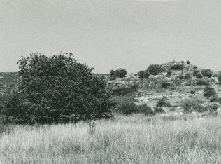
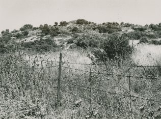
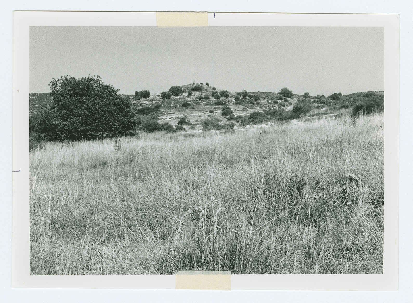
The houses have been reduced to levelled debris hidden beneath an overgrowth of wild vegetation. One can see the stones that served as fences for home gardens. Cactuses and carob, fig, and olive trees grow on the site. Cypress trees grow to the south of the site. The whole area is fenced in and used by Israeli farmers as pasture.